Community Corner
Snow Accumulations Possible Thursday
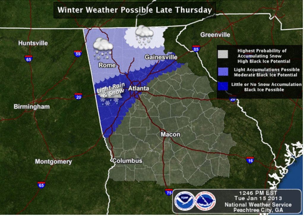
Tucker could get its first glimpse this winter of the white stuff as rain across north Georgia may turn to snow with the arrival of a deep cold air mass.

Tucker could get the first snow of the winter and 2013 on Thursday night, according to the National Weather Service.
A strong low pressure system and ample Gulf moisture will meet, resulting in widespread rain and an associated deep cold air mass that will begin to spread across north and central Georgia on Thursday afternoon and evening, meteorologists say in a special weather statement issued today. As a result, rain could change over to snow across parts of north Georgia.
Despite recent unseasonably warm temps, residents could see some light accumulations of snow across parts of north Georgia by mid to late Thursday afternoon or evening, mainly on elevated and grassy surfaces.
Find out what's happening in Tuckerwith free, real-time updates from Patch.
The best chance for accumulations would be generally north of the Interstate 20 corridor west of Atlanta and the Interstate 85 corridor east of Atlanta.
At this time, no travel difficulties are expected, except for in the north Georgia mountains where there's a better chance for higher accumulations. But patches of black ice could affect bridges and overpasses from late Thursday evening through mid-Friday morning when temps fall below freezing.
Find out what's happening in Tuckerwith free, real-time updates from Patch.
There may be areas of fog before 8 a.m. Thursday. The chance of rain is 100 percent, according to the NWS forecast. Showers will continue Thursday night when the low is expected to dip to 32. Friday will be mostly sunny with a high around 51.
Check back with Tucker Patch for updates as forecasts change.
Get more local news delivered straight to your inbox. Sign up for free Patch newsletters and alerts.
